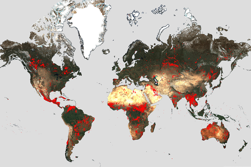
World Fire Atlas upgraded
The European Space Agency (ESA) has reopened the Atlas, allowing insight into the distribution of national and global wildfires using space technology.
The upgrade to the Atlas comes alongside an increase in global wildfire frequency. The European Forest Fire Information System reported that more than 234 516 hectares of land across the EU has already been burnt as of 29 July 2023.
The Copernicus Sentinel-3A satellite uses night-time data from the Sea and Land Surface Temperature Radiometer, which is like a thermometer in the sky measuring thermal infrared radiation from Earth's land surfaces. This is used to detect the fires. Satellite overpass constraints and cloud coverage can cause errors in the reporting.
The data comes in the form of pixels. A 705% increase in ‘fire pixels’ has been detected in the first half of 2023 in Canada, as compared to the previous six years, with 11,598 pixels detected in that period. This reflects the current state of wildfires in Canada, with the worst season on record and more than 100 bln m2 of land burned. This is predicted to increase in the coming weeks.
ESA’s Oliver Arino stressed the importance of space technology in environmental challenges. ‘The ongoing commitment of ESA, Copernicus and the EU to continuously provide this valuable resource reinforces the importance of leveraging space technology to address critical environmental challenges.’